FINAL UPDATE 8.55am, October 23:
Subscribe now for unlimited access.
or signup to continue reading
This live blog has ended. The Macleay Argus will continue to provide updates on the situation where needed.
The Willi Willi bushfire is currently being controlled with more than 28,000 hectares burnt.
Weather conditions yesterday (Sunday, October 22) put pressure of existing containment lines.
Crew will take advantage of milder conditions today before hot, dry and windy weather is forecast to return on Wednesday.
Crews will continue backburns implemented last night along the fire's southern edges in the areas, in the area of Eight Mile Road and Forest Road.
Residents are advised to monitor conditions, stay up-to-date and know what you will do if fire threatens.
If you are in the areas of Willi Willi, Warbro Brook, Willawarrin, Mungay Flat, Toorooka and Temagog, continue to monitor conditions as there are still pockets of active fire nearby.
BlazeAid director Gary Waterson will be arriving to Ironbark Farm at 597 Temagog Road, Temagog today around 11am.
He will be providing a meeting place for locals whose land has been devastated and to look at the wider Temagog situation.
Many affected by fires have lost fencing with only hay bales keeping livestock contained.
Donations of fencing materials are needed to help.
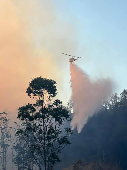
UPDATE 9.40pm, October 22:
The Willi Willi Road bushfire was downgraded to 'advice' level after 7pm this evening.
The fire, which has burned over 28,000 hectares is being controlled with firefighters working to strengthen containment lines.
Fire activity has eased across the fireground due to easing conditions.
Willi Willi, Warbro Brook, Willawarrin, Mungay Flat, Toorooka, and Temagog residents should continue to monitor conditions as there are still pockets of active fire nearby.
Remember to:
- Stay alert and monitor your surroundings
- Know what you will do if the fire impacts on where you are
- Identify a safer location in case the situation changes. This may include a well cleared area or a solid structure such as a home.
If you planned to visit the area, or live in the area but are away from home, do not return.
Boonanghi, Wittitrin and Yessabah residents should also stay up-to-date, monitor conditions and know what you will do if fire threatens.
If you planned to visit these areas, or live in the areas but are away from home, do not return.
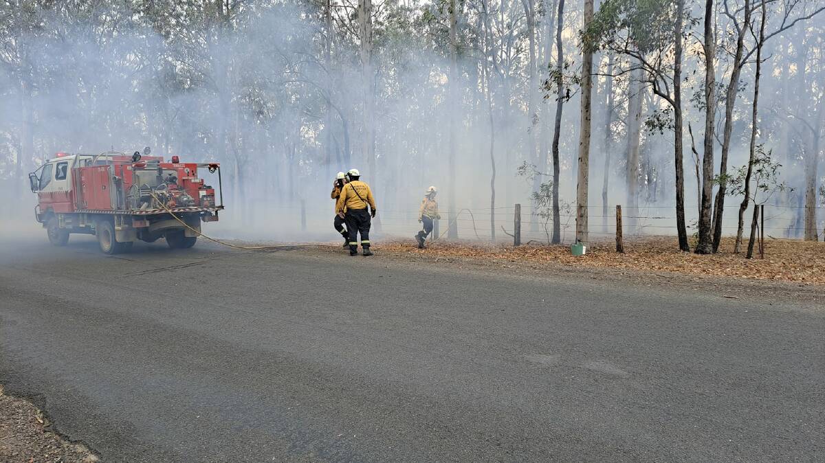
UPDATE 5.25pm, October 22:
The fire at Willi Willi Road has been upgraded to a 'watch and act'.
This afternoon, there was an increase in activity on the northern side of the fire ground in the vicinity of Toorooka and the fire jumped containment lines.
RFS crews are onsite with aircraft and ask Toorooka residents are asked to prepare now.
What you need to do
Toorooka
- If you are in the area of Brassils Creek Rd, Toorooka, you should Prepare Now.
- Fire may impact on your property. Make your final preparations now.
- Fill buckets, sinks and bath tubs with water ready to put out spot fires
- Block downpipes and fill your gutters with water to help stop burning embers. Do not get on the roof.
- Remove items which can burn from around your home, such as furniture and door mats.
- If you have firefighting equipment, get it ready now.
- Put on protective clothing made of natural fibres that covers all of your skin. Wear sturdy shoes. Have plenty of drinking water available.
- If you are not prepared, your safest option is to leave early.
Boonanghi, Wittitrin and Yessabah
- Under today's weather conditions, the fire has the potential to move in a southerly direction.
- f you are in the area of Boonanghi, Wittitrin or Yessabah, monitor conditions, stay up-to-date and know what you will do if fire threatens.
- Stay alert and monitor your surroundings.
- Watch out for emergency services personnel and follow their directions- this means looking out for burning embers, changes in wind direction and smoke. Watch for signs of fire in your area.
- Know what you will do if the fire impacts on where you are. Identify a safer location in case the situation changes. This may include a well cleared area or a solid structure such as a home.
- If you planned to visit the area, or live in the area but are away from home, do not return.
Willi Willi, Warbro Brook, Willawarrin, Mungay Flat, and Temagog
- Continue to monitor conditions as there are still pockets of active fire nearby.
- Stay alert and monitor your surroundings.
- Watch out for emergency services personnel and follow their directions.
- Know what you will do if the fire impacts on where you are. Identify a safer location in case the situation changes. This may include a well cleared area or a solid structure such as a home.
- If you planned to visit the area, or live in the area but are away from home, do not return.
If you are threatened by fire
- If the fire impacts, seek shelter in a solid structure such as a house to protect yourself from the heat of the fire.
- Bring pets indoors and restrain them, close all doors and windows and turn off air conditioners, keep water running if possible.
- Shelter in a room on the other side of the building from the approaching fire, and one that has water and a clear exit out of the house.
- Keep moving away from the fire if possible and if your building catches fire, go to an area within the building which has already burnt.
- Monitor both inside and outside for small fires and burning embers and turn sprinklers on if you have them.
- Be careful outdoors after the fire has passed as trees can be unstable and fall.
- If your life is at risk, call Triple Zero (000).
The other fire that RFS crews have been attending to at McGuires Crossing Road, near Hat Head is being controlled and has not changed it's alert level.
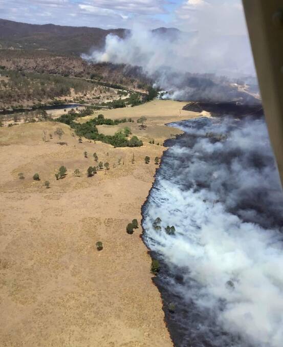
UPDATE 2.20pm, October 22:
A total fire ban is currently in force for the Kempsey, Nambucca and Port Macquarie-Hastings local government areas as bushfires continue at Willi Willi Road and McGuires Crossing Road.
A total of 189 homes, 104 outbuildings and four facilities have been saved from the fires.
185 firefighters supported by aircraft will be out today with a significant focus on the Willi Willi Road bushfire.
RFS public information officer Luke Robinson said that crews have been backburning along containment lines in the south and west of the fire over the past couple of days.
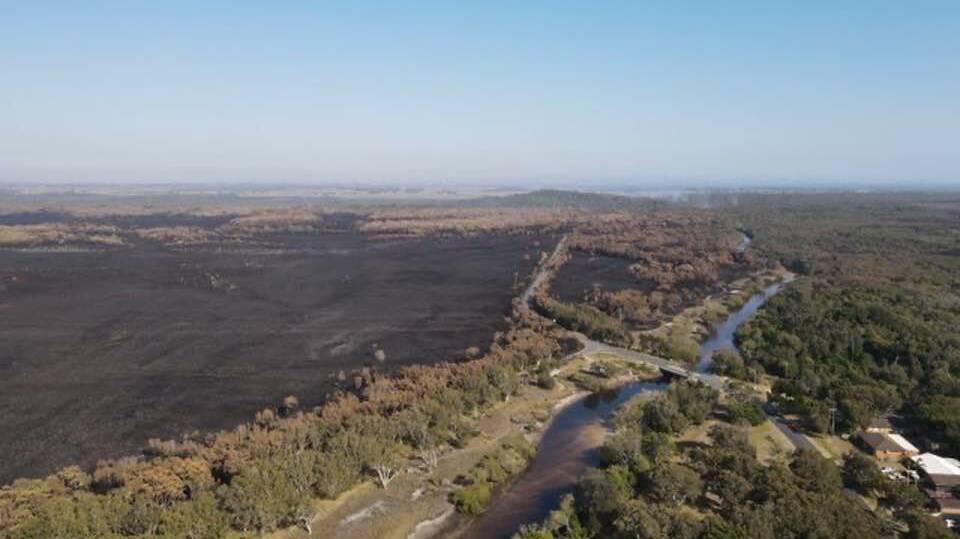
"We've still got threats in the inner west of the Willi Willi fire," he said.
"The key focus areas of today are in the western edge of the fire... and in the south of the fire in the Boonanghi State Forest area."
The fire at McGuires Crossing Road near Hat Head is still listed as 'being controlled' after being listed as 'controlled' yesterday (Saturday, October 21).
Mr Robinson said this was due to the weather forecast today with increased winds and hot temperatures.
"There are still hot spots around those edges," he said.
"We've got strategies in place to cool those hot spots however until they're out or not a threat, we don't want [the fire listed] as controlled."
Residents are advised to monitor conditions.
UPDATE 5pm, October 21:
A total fire ban will be in force for the Kempsey, Nambucca and Port Macquarie-Hastings local government areas (LGAs) starting from midnight tonight.
The ban comes as NSW RFS crews continue to work on fires at Willi Willi Road and McGuries Crossing Road.
NSW RFS inspector Chris Wilson said the conditions of the fires were similar to this morning.
Crews at McGuires Crossing near Hat Head have been holding and strengthening containment lines.
Work is also continuing at Willi Willi.
"We're doing some work with a large air tanker now in the western corner," Insp. Wilson said.
"And we're doing a significant amount of works to limit the spread and keep working towards that containment."
Winds speeds increased this afternoon with warmer weather forecast for tomorrow.
"We are seeing 30 to 40 km/hr winds between Coffs Harbour and Port Macquarie all the way up the coast," Insp. Wilson said.
"And we're going to see similar [conditions] again tomorrow."
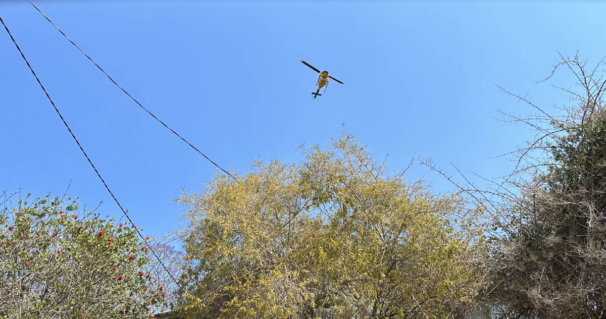
UPDATE 10.45 am, October 21:
Seven houses and 30 outbuildings have been confirmed to be lost to the fires within the Kempsey local government area (LGA) as RFS crews continue to battle blazes at Willi Willi Road and McGuires Crossing Road.
Nine houses and 15 outbuildings have also been damaged.
The fire danger rating today is at moderate but fire permits in the Kempsey and Nambucca LGA are suspended.
RFS inspector Chris Wilson said that crews will be focusing on strengthening and consolidating containment lines ahead of strong winds forecast for the afternoon.
"We do have 30 to 35 km/hr north-easterly winds potentially forecast for this afternoon so that's why we've put so much effort in," he said.
"With that sort of wind, we're always going to be worried especially leading into tomorrow.
"We're asking landowners please don't put a match to anything."
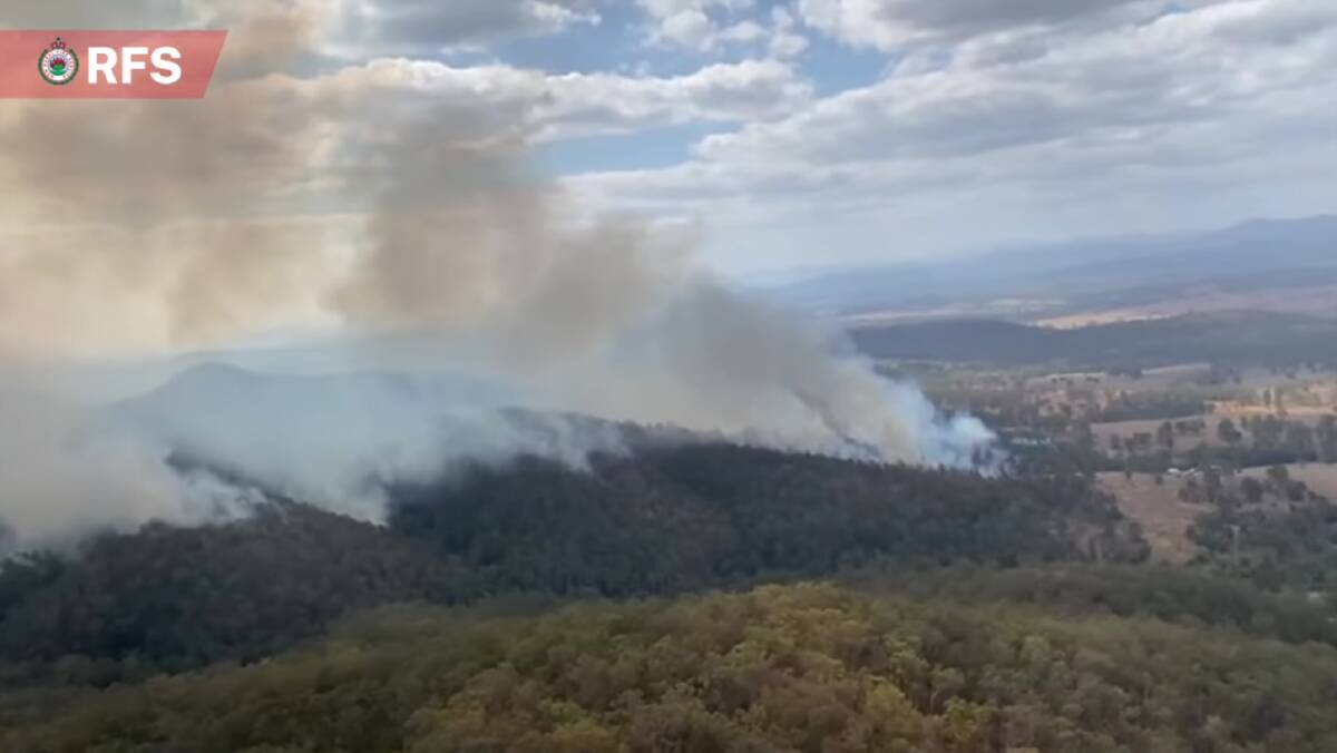
After the weekend, conditions are expected to ease before ramping up again on Wednesday, October 25.
"What we're saying is that even on those days it might come across as being benign, its dry enough now that even those benign days are really a concern," Insp. Chris Wilson.
The Willi Willi fire has burnt more than 26,000 hectares with fire activity increasing in the north west of the fireground late yesterday (Friday, October 20).
Insp. Wilson said amazing work had been done across the north and eastern parts of the fire and through the middle through Willi Willi Road to contain the fire.
Today, crews will be focusing on the south and west areas of the fire to try tie it into containment lines before worsening conditions.
"Temperatures [tomorrow] at this stage out there are potentially going to be up there in the mid to high 30's with relative humidity really low," Insp. Wilson said.
"So there are some concerns."
Willi Willi Road and Loftus Road are currently open however Temagog Road is closed, with access available only to local traffic.
Crews from multiple agencies also put in strong work at McGuires Crossing Road ahead of the changing conditions for the weekend by backburning around Hungry Road and Gap Road, Hat Head.
The fire, estimated to be 2,656 hectares in size continues to burn west towards Belmore River Right Bank Road through swamp land.
Residents in both impacted areas should:
- Stay alert and monitor their surrounding- look out for burning embers, changes in wind direction and smoke, and watch for signs of fire in their area
- Watch out for emergency services personnel and follow their directions.
- Know what they will do if the fire impacts on where they are. Identify a safer location in case the situation changes. This may include a well cleared area or a solid structure such as a home.
- If they planned to visit the area, or live in the area but are away from home, do not return.
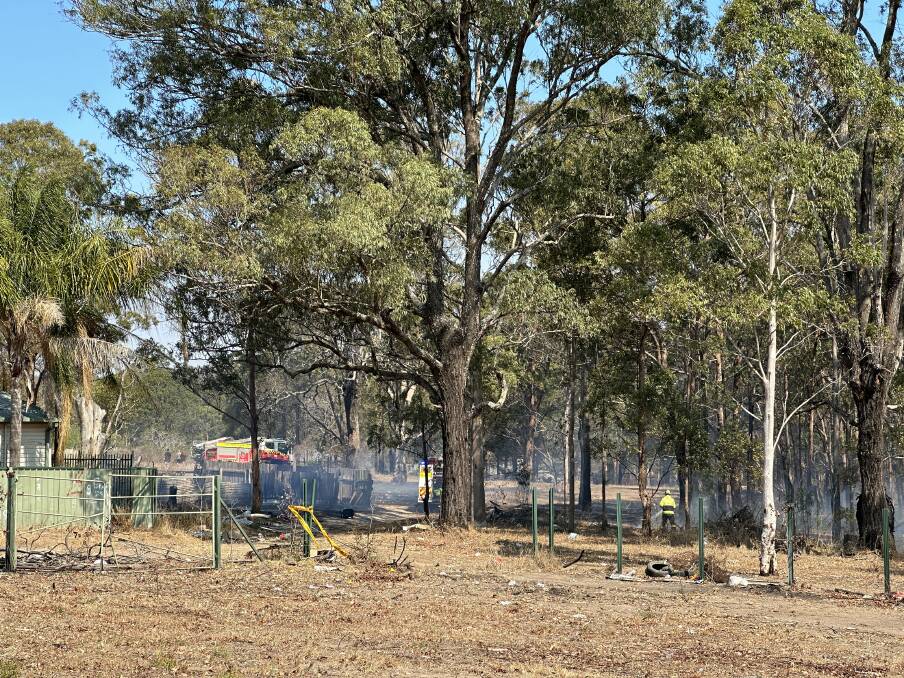
Firefighting agencies have also been focusing on a number of smaller fires across the Kempsey LGA including at Crescent Head, Verges Creek and South Kempsey.
The fires towards Crescent Head and Verges creek are currently contained with crews planned to patrol the area over the next couple of days with monitoring from both the ground and the air.
Insp. Chris Wilson said the smaller ongoing jobs can keep pulling resources and tiring volunteers out.
"Our crews have been going hard since August so we're talking eight to 10 weeks," he said.
"Unless we get any sort of decent rain in the near future, that's going to keep happening."
UPDATE 5.10pm, October 20:
Firefighting crews have continued to focus on the fires at Willi Willi and McGuires Crossing Road ahead of increased temperatures and winds forecast for the weekend.
"That will provide us with some challenging conditions which will make things a little more difficult for firefighters," said RFS Operational Officer Michael Dunn.
"But hopefully the preparation works we've done of the last couple of days will assist with those operations."
Firefighters managed to take advantage of favourable conditions over the past two days to implement a number of backburns to the McGuires Crossing Road fire.
The work will continue over the coming days as firefighters, aircraft and heavy machinery work to further strengthen containment lines.
Backburns were also implemented on the southern edge the Willi Willi fire to help strengthen containment lines.
Fire activity has increased in the north-west area of the fire zone however is still within the identified containment area.
More RFS building assessments were made today however the results are yet to be revealed.
There have been reports of livestock death however the exact number is yet to be confirmed, with Need for Feed delivering hay yesterday afternoon.
A number of other fires are also occurring in the Kempsey Shire including fires at Crescent Head Road and part of South Kempsey.
UPDATE 9am, October 20:
NSW Rural Fire Service (RFS) Lower North Coast have confirmed that seven houses and 15 outbuildings have been lost due to the Willi Willi fires as of 5.30pm Thursday, October 19.
The RFS building assessment team were able to confirm 114 houses, two facilities and 55 outbuildings had been saved but building impact assessments will be ongoing.
The RFS is also hosting a bushfire information point at the intersection of Willi Willi Road and Warbro Brook Road between 10.30am and 1.30pm today (Friday, October 20).
The information point will have member of the field liaison team to provide information about the Willi Willi fire, a newsletter and a map of the burnt area.
The team will be answering any questions that the public have.
UPDATE 8.35am, October 19:
Easing condition yesterday proved to be a big help for fighfighters.
Crews fighting the McGuires Crossing Road bushfire near Hat Head were able to take advantage of favourable condtions.
A single lane is open on Hat Head Road for local traffic at reduced speeds.
Crescent Head Road has also been reopened.
Firefighters were able to implement backburns to the south of Hat Head along Gap Road and Hungry Road, and to the north of the town, east of Hat Head Road.
This work will continue over the coming days.
Currently, there is not immediate threat to Hat Head.
The Willi Willi fire has burnt more than 22,300 hectares and is being controlled by crews.
As conditions allow, crews may implement backburning strategies along the fire's southern and western edges.
Residents in the area should expect to see an increase in smoke and fire activity as a result of these operations.
With more than 110km of fire edge to contend with, firefighters will be working in the area for many days to come.
Bellbrook Public School and Willawarrin Public School will be open today.
Residents affected by both fires are advised to stay alert and monitor their surroundings.
UPDATE, 2pm, October 18:
NSW Rural Fire Service (RFS) Commissioner Rob Rogers said that fire fighters will be working on containing for the Willi Willi fire which is now over 22,000 hectares in size.
"The priority for the teams at the moment is containing the fire to the east and the southern part of that fire," he said
"And that's in anticipation of strong westerly winds and hot temperatures returning on the weekend.
"So its a bit of a race at the moment to try and get as much containment on this fire ahead of that worsening weather."
RFS crews are expecting warm weather over the weekend and are preparing as best they can in the lead up.
"On the weekend we'll have increased volunteers on the fire ground as well," NSW Rural Fire Service Lower North Coast district manager Superintendent Liz Ferris said.
"It's predicted and we're planning for it."
180 firefighters have been on the ground with nine air craft fighting the blaze.
Commissioner Rogers said that one of the concerns for the weekend is that conditions will be similar to when the fire was at it's worse and that the fire could escape containment lines, potentially running into property.
"If we can get through the weekend without this fire expanding significantly then the focus will return to trying to get actual containment," Commissioner Rogers said.
"But this fire is not going to be out in a matter of days- its going to be a couple of weeks."
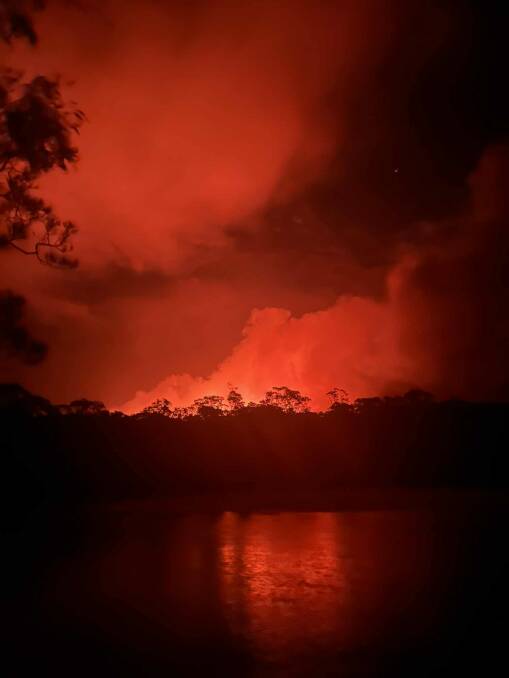
RFS crews are still fighting other fires in the area.
The McGuires Crossing Road bushfire near Hat Head is currently being controlled by RFS crews.
"They've got good strategies in containing that fire," Commissioner Rogers said.
"And we're hopeful either today or tomorrow we'll get containment on that fire which will be a good relief for people in that area."
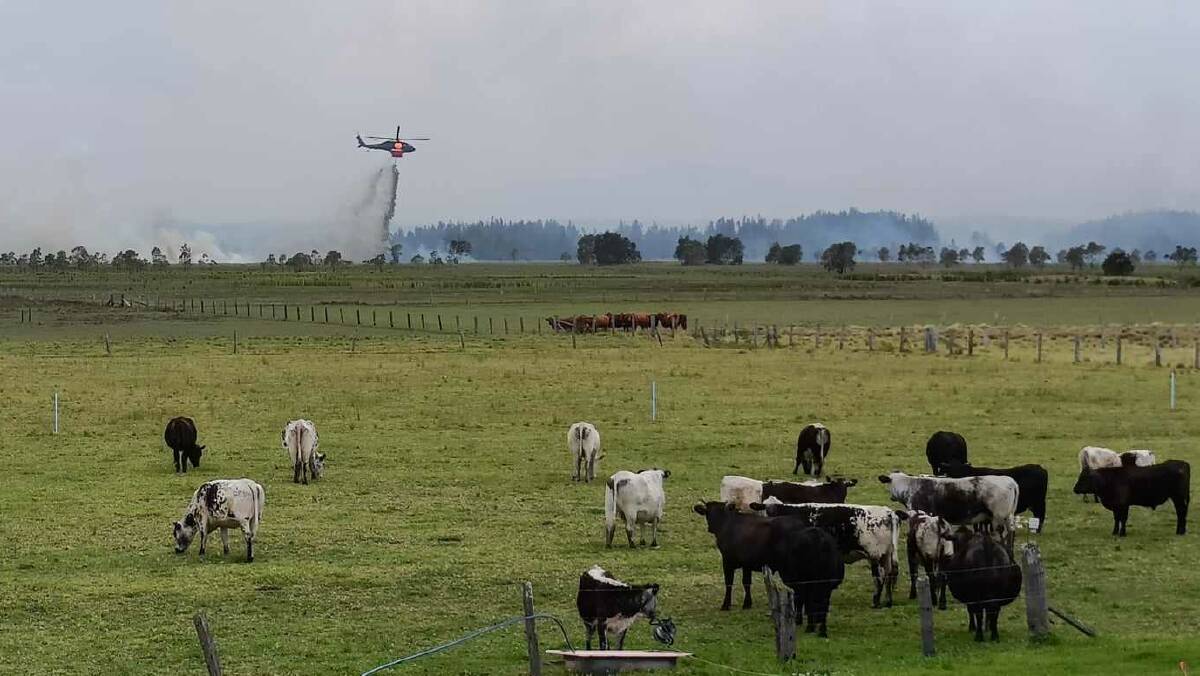
UPDATE: 8am, October 18:
The Kempsey Showground Evacuation Centre will now be open until further notice.
Firefighters have been working to contain two fires burning in the Kempsey Shire overnight.
The Willi Willi Fire and McGuires Crossing Rd have both been downgraded to Watch and Act level.
The McGuires Crossing Rd Fire has been burning in the Hat Head National Park, to the south west of Hat Head.
Residents in the Hat Head area are still advised that it is too late to leave.
If residents evacuated north towards South West Rocks, or left the area, it is not yet safe to return to Hat Head.
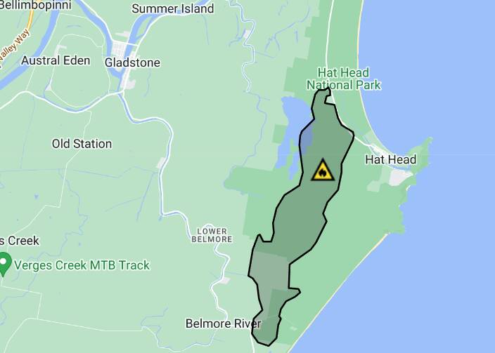
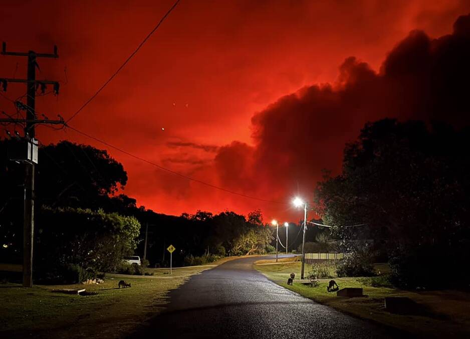
Hat Head Rd is closed at the intersection of Kinchela Creek Right Bank Rd.
Additional fire trucks are also present in Hat Head.
The fire at Willi Willi remains out of control, with more than 22,3000 hectares burnt.
Southerly winds are pushing the fire in a northerly direction with crews actively firefighting and protecting properties around Warbro Brook Rd, Stoney Creek Rd, Roller Coaster Rd, Willi Willi Rd, and Turners Flat on the eastern and northern edges of the fire.
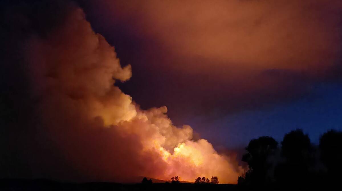
Crews are monitoring the spread of the fire to the northwest and south, and are preparing control lines
Residents in Willi Willi, Warbro Brook, Willawarrin, Mungay Flat, Temagog, Toorooka, Carrai Road or Toorumbee Road should:
- monitor conditions as there is still active fire in the area
- Stay alert and monitor your surroundings.
- Watch out for emergency services personnel and follow their directions.
- Look out for burning embers, changes in wind direction and smoke. Watch for signs of fire in your area.
- Know what you will do if the fire impacts on where you are. Identify a safer location in case the situation changes. This may include a well cleared area or a solid structure such as a home.
- If you planned to visit the area, or live in the area but are away from home, do not return.
Fires at Crescent Head Rd are currently under control.

UPDATE: 6.30pm, October 17:
Firefighters are on the scene of a fire burning in the vicinity of McGuires Crossing Rd, 16km east of Kempsey. It has been listed as a watch and act.
The fire is burning between McGuires Crossing Rd and Loftus Rd, burning in a northerly direction. The fire may impact Hat Heat Rd, cutting off access to the area.
For residents in the vicinity of Hat Head who plan to leave, they are advised to leave now in a northerly direction towards South West Rocks. For more information, visit the Hazards Near Me app and RFS website.
The Kempsey evacuation centre at Kempsey Showground will remain open tonight and will be unstaffed on Wednesday, October 18.
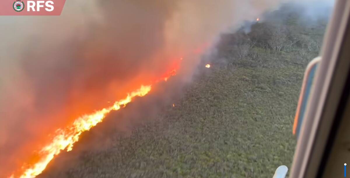
UPDATE: 4.30pm, October 17:
A number of road are closed due to the fires at Willi Willi and Crescent Head.
Kempsey Shire Council announced that the following roads are closed:
- Temagog Road closed at Armidale Road
- Willi Willi Road closed at Temagog Road.
- Crescent Head Road closure both directions Between 605 Crescent Head Road and Seale Road (fire near or crossing road)
The road closures are in place to limit the area to local residents only.
School buses travelling through Crescent Head Road will be escorted through by RFS vehicles.
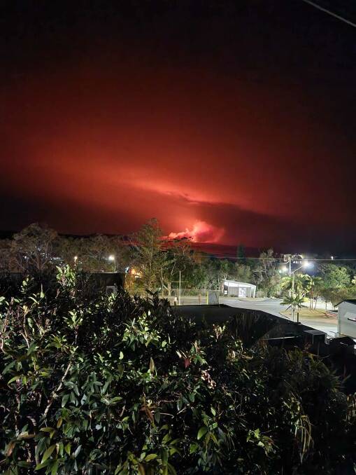
UPDATE: 2pm, October 17:
Mid North Coast Police Superintendent Shane Cribb described the death of a 56-year-old man as an absolute tragic incident.
Police were called to Stony Creek Lane, Temagog, after concerns were raised for the man's welfare about 10.15pm on Monday, October 16.
Officers travelled into the high-risk fire danger area with the support of the Rural Fire Service (RFS).
"After walking around for some time, police located a 56-year-old male deceased approximately 100 metres from a bulldozer that was also burnt," Supt. Cribb said.
Police aren't able to confirm what the man was doing in the lead-up to his death, but believe that he was possibly putting in containment lines to try and prevent the fire from spreading.
"The family are devastated as you'd imagine," Supt. Cribb said.
"We'll make sure we pack as much welfare around the family as we can and make sure the other agencies are involved in providing whatever support we can bring to the community."
The cause of the Willi Willi Fire is not yet known, but Supt. Cribb said it is being investigated.
NSW Rural Fire Service Lower North Coast district manager Superintendent Liz Ferris said she estimates it will take the next five days to contain the out of control fire.
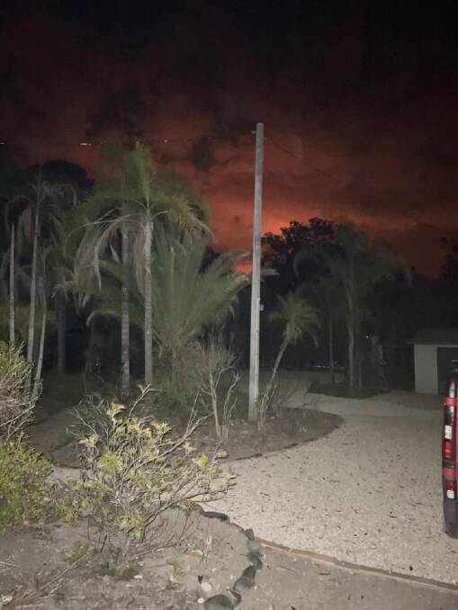
"We're moving towards this containment strategy ahead of... worse weather predicted between Saturday and Sunday this week," she said.
Local and out of area fire crews have been fighting the blaze with air and land support.
Supt. Ferris said that the fire at Willi Willi is expected to move in a north easterly direction today and that large air tankers are planned to be used to help with retardant lines.
"We have put... what we call a heavy weighted attack on there and we're trying to protect the community as best we can," Supt. Ferris said.
"At the moment our strategic planners are looking at how best we can contain this fire."
There are multiple fires currently burning in the Kempsey Shire, with two fires now burning along Crescent Head Rd.
"We also have moved our crew out that side as well and we'll continue to work on strategies of containment for those two [fires] as well," Supt. Ferris said.
For those affected by the fire with livestock, Supt. Cribb recommended they ring their Local land Services for support on 1300 795 299.
The Kempsey Regional Salesyards are currently open for livestock refuge.
Current situation:
- The fire is burning in Willi Willi National Park and Boonanghi Nature Reserve.
- The fire has burnt more than 21,000 hectares and is yet to be contained.
- Crews are actively firefighting and protecting properties around Warbro Brook Road, Stoney Creek Road, Roller Coaster Road, Willi Willi Road and Turners Flat on the eastern and northern edges of the fire.
- Crews are monitoring the spread of the fire to the northwest around the localities of Willi Willi, Carri Road and Stubbs Road and preparing future containment options.
- In the south in the vicinity of Bullock Rd, crews are monitoring fire spread and utilising heavy plant to prepare control lines.
- Fire activity is predicted to increase from the late afternoon and into the early evening to the north east ahead of active fire fronts.
- Southwesterly winds are forecast across the day, which will continue to push the fire in a northerly direction.
- An evacuation centre for residents who have been affected by the Willi Willi Rd Fire has been established at the Kempsey Showground, 19 Sea Street, West Kempsey.
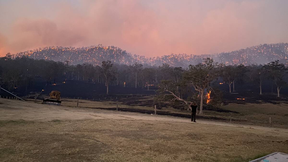
UPDATE: 8.10am, October 17:
A crime scene has been established after man's body has been found after the bushfire passed though the Temagog area.
Emergency services were called to Stony Creek Lane at Temagog, about 10.15pm on Monday, October 16 after concerns were raised for a 56-year-old man, missing after a bushfire passed through the area.
Officers from the Mid North Coast Police District located the body of the man; his bulldozer nearby was destroyed.
The man is yet to be formally identified, but is believed to be a local property owner.
Investigations are continuing into the circumstances surrounding the incident.
A crime scene has been established and a report will be prepared for the Coroner.
Kempsey Shire Mayor Leo Hauville has called the man's death a "tragedy" and the fires as "a major problem happening within Kempsey Shire".
"Today, we will do our best to keep going with our business of council, but in the back of all of our minds will be the hard work and distress of what's going on," he said.
"[The RFS] are doing an amazing job and they are coping with horrendous wind conditions that are making it very difficult to control the fires. I salute all those people doing that."
RFS crews are continuing to fight the fire with air support providing assistance.
The fire has now burnt through over 10,900 hectares.
RFS Operational Officer Michael Dunn said the extent of property damage due to the fire is unknown at this stage.
"We are having our building impact analysis team deployed in the field to make an assessment on that," he said.
"We do have crews currently on the grounds assessing what's happened overnight.
"They are pretty much going to property by property and responding to any calls that we get for assistance."
UPDATE 7.30am, October 17:
The fire has burnt more than 9600 hectares and is yet to be contained.
Conditions eased on the fireground overnight, with firefighters continuing to contain the fire.
If you are in Willi Willi, Warbro Brook, Willawarrin, Mungay Flat, Temagog or Toorooka, you should monitor conditions, as there is still active fire. Watch out for emergency services personnel and follow their directions.
Bellbrook Public School and Willawarrin Public School will be closed today, Tuesday October 17.
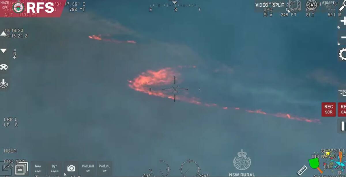
UPDATE: 7.45pm, October 16:
The RFS has advised it is too late to leave Willawarrin.
If you are in the areas of Willawarrin, Mungay Flat, Toorooka and Temagog you are at risk. Seek shelter to protect yourself from the fire as it is now too late to leave.
"It is too late to leave. Shelter now. Earlier there was messaging for properties on Willi Willi Road on the eastern side that they could travel east towards Kempsey," a spokeswoman for the RFS said.
"The message for properties along Willi Willi Road now is also, it is too late to leave. Shelter now."
What you need to do
Willi Willi, Warbro Brook, Willawarrin, Mungay Flat, Temagog, Toorooka
- If you are in Willi Willi, Warbro Brook, Willawarrin, Mungay Flat, Temagog, Toorooka you are at risk. Seek shelter in a solid structure such as a house. Do not be caught in the open in the path of the fire.
- Go inside and protect yourself from the fire front. Actively monitor the situation.
- A safer location may include a well cleared area nearby. Neighbourhood safer places offer a place of last resort if there are no other options.
- If you planned to visit the area, or live in the area but are away from home, do not return.
Toorumbee Rd and Willi Willi Rd
- If you are in the area of Toorumbee Rd area your life is at risk. Seek shelter in a solid structure such as a house. Do not be caught in the open in the path of the fire.
- If you are east of Moparrabah along Willi Willi Rd it is now too late to leave. Seek shelter in a solid structure such as a house. Do not be caught in the open in the path of the fire.
- Go inside and protect yourself from the fire front. Actively monitor the situation.
- A safer location may include a well cleared area nearby. Neighbourhood safer places offer a place of last resort if there are no other options.
- If you planned to visit the area, or live in the area but are away from home, do not return.
Current Situation
- The fire is burning in Willi Willi National Park and Boonanghi Nature Reserve and is moving in an easterly direction.
- The fire has burnt more than five thousand eight hundred hectares and is yet to be contained.
- South westerly winds have caused the fire to cross the MacLeay River.
- A southerly change is expected this evening which will see the fire move in a more northerly direction.
- Strong winds are causing erratic fire activity. This may cause spot fires ahead of the main fire front.
- Firefighters and aircraft are working in the area to protect properties.
- An evacuation centre for residents who have been affected by the Willi Willi Rd Fire has been established at the Kempsey Showground, 19 Sea Street, West Kempsey.
UPDATE: 6.30pm, October 16:
An evacuation centre for residents who have been affected by the Willi Willi Rd Fire has been established at The Kempsey Showground - 19 Sea Street, West Kempsey.
Residents able to evacuate from Willawarrin and surrounding areas are encouraged to seek shelter at the Kempsey evacuation centre.
UPDATE: 4.30pm, October 16:
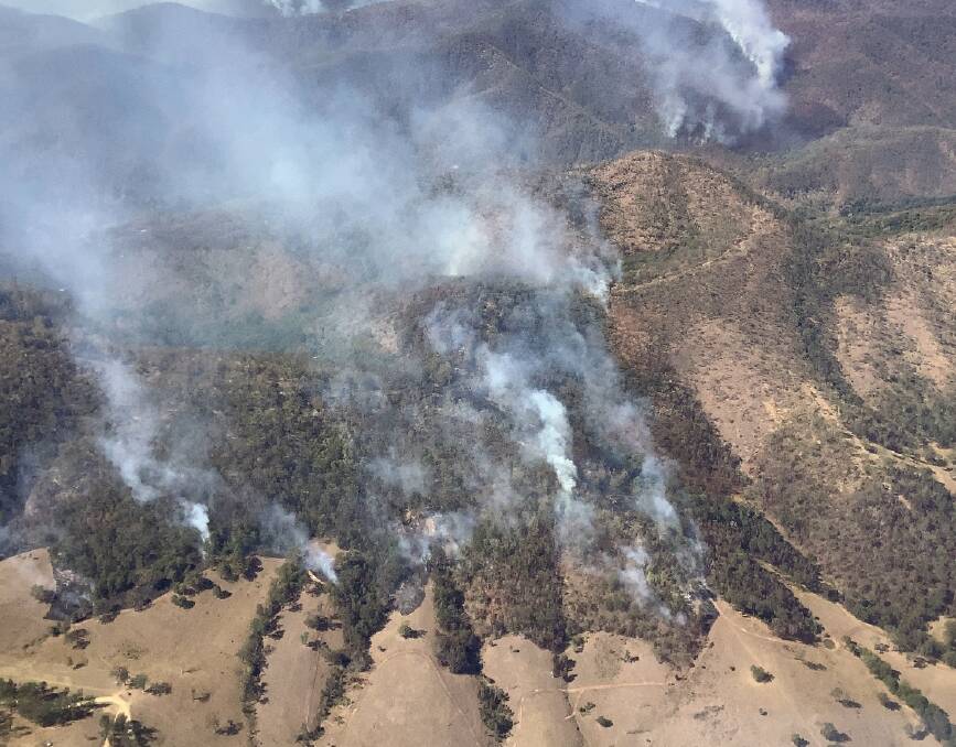
An emergency warning has been issued to residents in the McCoys Creek Road and Toorumbee Road area as a fire burning in Willi Willi National Park continues to threaten properties 30 kilometres west of Kempsey.
The fire, which is burning in Willi Willi National Park and Boonanghi Nature Reserve, is moving in multiple directions due to erratic fire behaviour.
The fire is burning to the west Toorumbee Road with westerly winds causing the fire to jump the road.
A southerly change is expected this evening which will see the fire move in a more northerly direction.
What residents need to do
Toorumbee Road:
- Your life is at risk
- Seek shelter in a solid structure such as a house.
- Do not be caught in the open in the path of the fire.
- If you are east of Moparrabah along Willi Willi Rd and the path is clear head east towards Kempsey.
- Go inside and protect yourself from the fire front. Actively monitor the situation.
- A safer location may include a well cleared area nearby.
- Neighbourhood safer places offer a place of last resort if there are no other options.
- If you planned to visit the area, or live in the area but are away from home, do not return.
- Watch out for emergency services personnel and follow their directions.
Willawarrin:
- You are at risk
- Leave now if the path is clear along Armidale Rd south towards Kempsey.
- Do not wait. Roads may become blocked or access may change, smoke may reduce visibility.
- Act now to protect yourself and your family. Conditions may get worse quickly.
- Leaving at the last minute is deadly.
Toorooka and Hickeys Creek:
- If you are in the area of Toorooka, and Hickeys Creek you are advised to prepare now as the southerly wind change may push the fire north.
- Residents in Toorooka and Hickeys Creek may be affected by smoke and embers.
- Fire may impact on your property. Make your final preparations now.
- Remove items which can burn from around your home, such as furniture and door mats.
- If you are not prepared, your safest option is to leave early.
The fire is estimated to have burnt through 4560 hectares.
UPDATE: 3pm, October 16:
Westerly winds have cause the fire to spot across Toorumbee Road with strong wins causing erratic fire activity.
Residents are being advised to leave now if not prepared.
If the path is clear, head north along Toorumbee Road and then east along Willi Willi Road towards Kempsey
Residents staying are advised to monitor conditions, watch out for signs of fire in their area and know what to do if a fire impacts where they area.
Fire may impact land owners property and they should make their final preparations now with a safer location identified in case the situation changes.
If not prepared to the highest level, leaving early is the safest option.
UPDATE: 2.20pm, October 16:
Rural Fire Service (RFS) crews were called out to the fire around midday on Saturday, October 14.
The fire allegedly was started by a resident burning rubbish in a drum.
RFS Inspector Chris Wilson said winds swinging from the north west around to the west had made conditions challenging not only for ground crews but aviation assets.
"The fire is now up to 1800 hectares and providing quite a few challenges today for the crew," he said.
"On Saturday it started escalating and we had ground and aviation crews working hard to provide a containment strategy but conditions were not allowing that.
"That continued to escalate yesterday under drying conditions and now today with weather conditions, its making it extremely difficult to get ahead of the fire."
Three helicopters and number of large air tankers have been deployed to fight the fire over the weekend with National Parks providing a significant contribution to the fire fighting.
Forestry Cooperation of NSW as well as Fire and Rescue have also been attending to a number of fires throughout the Kempsey area over the weekend.
"The service is actively attacking this fire with everything they can," Mr Wilson said.
"We strongly encourage landowners to have a plan for what they're going to do if fire approaches and they ever find themselves in that situation."
The fire arrived just days before a total fire ban was announced for the Kempsey, Port Macquarie-Hastings and Nambucca local government areas on Monday, October 16.
"The decision was made due to the higher temperature...and strengthening winds," Mr Wilson said.
"In the Lower North Coast, we've made the determination that no new permits will be issued due to the dry conditions we're facing at the moment."
Mr Wilson said that existing permits were also suspended for any day that the fire danger rating is high or above.
Residents are reminded to be prepared for fires this bush fire danger season, check the Hazards NSW app or website and visit the RFS website for any further information.
IN OTHER NEWS:

